Bryncethin Ford - Afon Ogwr
Introduction
The photograph on this page of Bryncethin Ford - Afon Ogwr by John Walton as part of the Geograph project.
The Geograph project started in 2005 with the aim of publishing, organising and preserving representative images for every square kilometre of Great Britain, Ireland and the Isle of Man.

There are currently over 7.5m images from over 14,400 individuals and you can help contribute to the project by visiting https://www.geograph.org.uk
Bryncethin Ford - Afon Ogwr
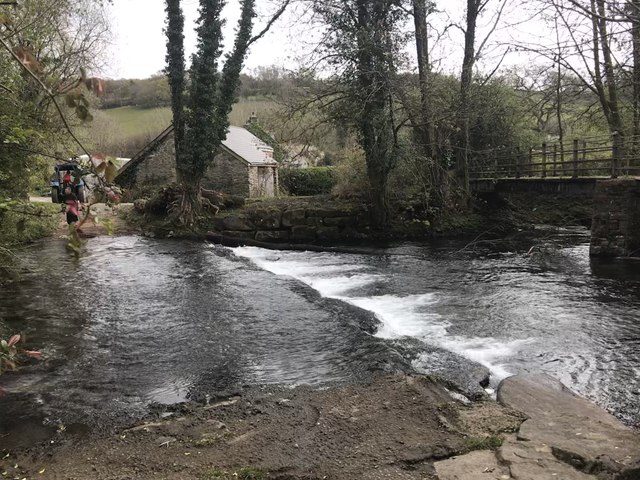
Image: © John Walton Taken: 14 Apr 2019
This ford is found on the Ogmore River near Bryncethin. The byway joins the Ogmore Valley cycle route just beyond the ford. The footbridge was constructed by two local councils and consequently is made of two different materials on either side of the river. In order to protect the bridge the farmer was dragging a log out of the river with his tractor. A video of the ford can be seen at: https://youtu.be/bhW3Y6pcTuI
Images are licensed for reuse under creativecommons.org/licenses/by-sa/2.0
Image Location
Latitude
51.557862
Longitude
-3.563604