The A555 Manchester Airport Eastern Link Road
Introduction
The photograph on this page of The A555 Manchester Airport Eastern Link Road by Graham Hogg as part of the Geograph project.
The Geograph project started in 2005 with the aim of publishing, organising and preserving representative images for every square kilometre of Great Britain, Ireland and the Isle of Man.

There are currently over 7.5m images from over 14,400 individuals and you can help contribute to the project by visiting https://www.geograph.org.uk
The A555 Manchester Airport Eastern Link Road
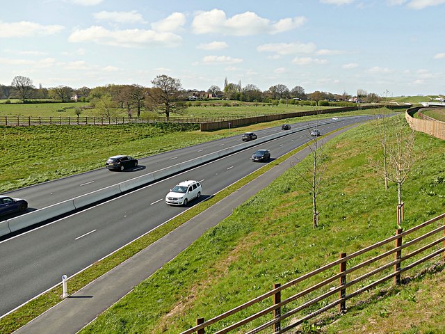
Image: © Graham Hogg Taken: 12 Apr 2019
The road was first planned in 1962 and, much revised, was completed in October 2018. This view is from a public footpath to the north of the new road. Unusually for a new dual carriageway road, there is an unprotected footpath and cycleway adjacent to the eastbound carriageway.
Images are licensed for reuse under creativecommons.org/licenses/by-sa/2.0
Image Location
Latitude
53.357216
Longitude
-2.132779