The Fulton Block, RAF Cosford
Introduction
The photograph on this page of The Fulton Block, RAF Cosford by Richard Law as part of the Geograph project.
The Geograph project started in 2005 with the aim of publishing, organising and preserving representative images for every square kilometre of Great Britain, Ireland and the Isle of Man.

There are currently over 7.5m images from over 14,400 individuals and you can help contribute to the project by visiting https://www.geograph.org.uk
The Fulton Block, RAF Cosford
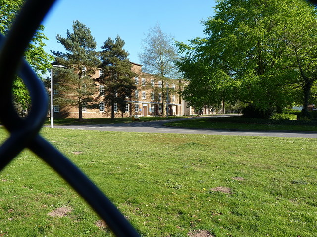
Image: © Richard Law Taken: 21 Apr 2019
Seen through the fence (and hoping the MOD don't mind too much...!) this is about the best view you can get of the rather grand Grade II listed https://britishlistedbuildings.co.uk/101407287-fulton-block-raf-cosford-donington#.XL2mrOhKjIU & https://historicengland.org.uk/listing/the-list/list-entry/1407287 Fulton Block building. It was built as a combined barracks, institute and mess in the late 1930s to a design by the Air Ministry's Directorate of Works and Buildings under J.H. Binge, and was intended to accommodate 1000 servicemen at a time. Mainly brick and concrete, with flat roofs and steel windows.
Images are licensed for reuse under creativecommons.org/licenses/by-sa/2.0
Image Location
Latitude
52.64908
Longitude
-2.309025