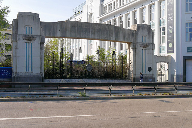
Former Gateway to Manchester Docks, Trafford Road
Introduction
The photograph on this page of Former Gateway to Manchester Docks, Trafford Road by David Dixon as part of the Geograph project.
The Geograph project started in 2005 with the aim of publishing, organising and preserving representative images for every square kilometre of Great Britain, Ireland and the Isle of Man.
There are currently over 7.5m images from over 14,400 individuals and you can help contribute to the project by visiting https://www.geograph.org.uk

Image: © David Dixon Taken: 19 Apr 2019
The Manchester Ship opened in 1894. A complex of 9 docks was built at the eastern end of the canal on both the Salford and Manchester sides. These docks formed a key part of the Port of Manchester from 1894, until its closure in 1982. There is now little of the docks remaining following the area's regeneration as “Salford Quays” (and more latterly) MediaCityUK. One feature that has been retained is the former dock entrance gateway on Trafford Road. Designated as a Grade II listed building (Historic England List Entry Number: 1386183 https://historicengland.org.uk/listing/the-list/list-entry/1386183 ), the gateway was built ca1925 at the same time as the adjacent dock office. The words "Manchester Docks" once ran across the top of the gateway. Two sculptural motifs reminiscent of ships' keels project out from the stonework on either side. The original gates have been replaced with a late twentieth century screen. http://manchesterhistory.net/manchester/outside/SALFORD/dockoffice.html Manchester History Net

