New River and West Reservoir
Introduction
The photograph on this page of New River and West Reservoir by Glyn Baker as part of the Geograph project.
The Geograph project started in 2005 with the aim of publishing, organising and preserving representative images for every square kilometre of Great Britain, Ireland and the Isle of Man.

There are currently over 7.5m images from over 14,400 individuals and you can help contribute to the project by visiting https://www.geograph.org.uk
New River and West Reservoir
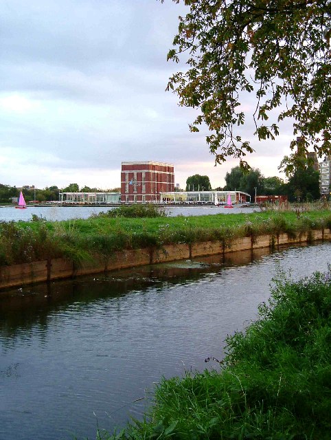
Image: © Glyn Baker Taken: 4 Oct 2005
The canal in the foreground is the New River, which was constructed between 1609-1613 from Ware in Hertfordshire to Islington bringing drinking water into London. The Stoke Newington east and west reservoirs and their associated treatment works were constructed in the 1830’s to pump water into proper water mains to London. The new river by this time had become more like a sewer than a source of water. Most of the “river” was covered over although one small section survives in a linear park see Image The West reservoir shown in the picture has been redundant as a drinking water source since shortly after the Second World War. The water works building is now a water sports centre. The East Reservoir still gets its water from the New River although it is piped to Walthamstow for treatment.
Images are licensed for reuse under creativecommons.org/licenses/by-sa/2.0
Image Location


Leaflet Map data © OpenStreetMap
Latitude
51.566339
Longitude
-0.091165