Direction Sign ? Signpost at West Chinnock
Introduction
The photograph on this page of Direction Sign ? Signpost at West Chinnock by Milestone Society as part of the Geograph project.
The Geograph project started in 2005 with the aim of publishing, organising and preserving representative images for every square kilometre of Great Britain, Ireland and the Isle of Man.

There are currently over 7.5m images from over 14,400 individuals and you can help contribute to the project by visiting https://www.geograph.org.uk
Direction Sign ? Signpost at West Chinnock
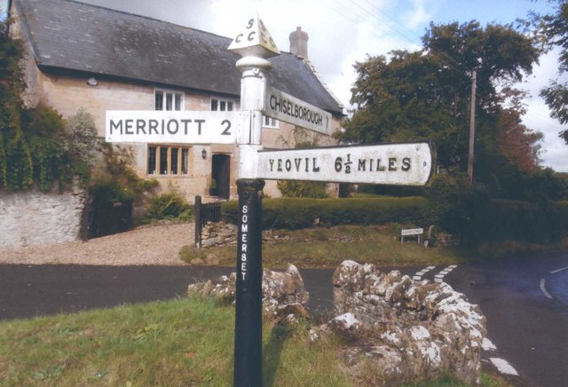
Image: © Milestone Society Taken: Unknown
Located on a raised grass triangle in the centre of the junction of Duckpool Lane, Higher Street and East Lane in West Chinnock parish. 3 arms and pyramid finial. See also http://www.flickr.com/photos/tollhouses/5615740841/ and https://www.geograph.org.uk/photo/6049784. Milestone Society National ID: SO_ST4613
Images are licensed for reuse under creativecommons.org/licenses/by-sa/2.0
Image Location


Leaflet Map data © OpenStreetMap
Latitude
50.915362
Longitude
-2.758866