Boundary wall, High Ham
Introduction
The photograph on this page of Boundary wall, High Ham by Derek Harper as part of the Geograph project.
The Geograph project started in 2005 with the aim of publishing, organising and preserving representative images for every square kilometre of Great Britain, Ireland and the Isle of Man.

There are currently over 7.5m images from over 14,400 individuals and you can help contribute to the project by visiting https://www.geograph.org.uk
Boundary wall, High Ham
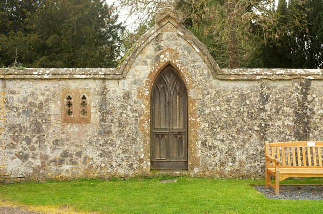
Image: © Derek Harper Taken: 13 Apr 2019
From the listed building description at https://historicengland.org.uk/listing/the-list/list-entry/1056662 : "Adds to setting of Churchyard, which it abuts, and east side of village green generally ... central pointed orchard gateway with pointed arched gable over, in Strawberry Hill Gothic style". Beyond are the grounds of Ham Court.
Images are licensed for reuse under creativecommons.org/licenses/by-sa/2.0
Image Location


Leaflet Map data © OpenStreetMap
Latitude
51.075703
Longitude
-2.82171