The 'Wellington at Waterloo', Waterloo Road, London
Introduction
The photograph on this page of The 'Wellington at Waterloo', Waterloo Road, London by Dr Neil Clifton as part of the Geograph project.
The Geograph project started in 2005 with the aim of publishing, organising and preserving representative images for every square kilometre of Great Britain, Ireland and the Isle of Man.

There are currently over 7.5m images from over 14,400 individuals and you can help contribute to the project by visiting https://www.geograph.org.uk
The 'Wellington at Waterloo', Waterloo Road, London
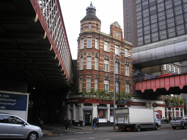
Image: © Dr Neil Clifton Taken: 13 Nov 2007
This interesting photograph shows the large Victorian public house and hotel, which extends to the far side of the right-hand bridge. There are plenty of pubs called 'The Wellington', but not many have the advantage of him actually being at Waterloo! The left hand bridge here carries the railway tracks from Waterloo East onto Hungerford Bridge over the Thames, leading to Charing Cross. The lower one of the right hand pair of bridges once carried a connecting rail track from Waterloo East to Waterloo Main Line, but as this track crossed the concourse it was of limited use, and was removed many years ago, after which the bridge carried a passenger footway. However, with fairly recent re-modelling of facilities here, the pedestrians now use the new bridge above which carries them safely above the cab road (it was quite dangerous to cross) and down by escalator onto the main line concourse.
Images are licensed for reuse under creativecommons.org/licenses/by-sa/2.0
Image Location
Latitude
51.503529
Longitude
-0.110794