
Blocked path from Shotton High Level station to Shotton Low Level station
Introduction
The photograph on this page of Blocked path from Shotton High Level station to Shotton Low Level station by Jaggery as part of the Geograph project.
The Geograph project started in 2005 with the aim of publishing, organising and preserving representative images for every square kilometre of Great Britain, Ireland and the Isle of Man.

There are currently over 7.5m images from over 14,400 individuals and you can help contribute to the project by visiting https://www.geograph.org.uk
Blocked path from Shotton High Level station to Shotton Low Level station
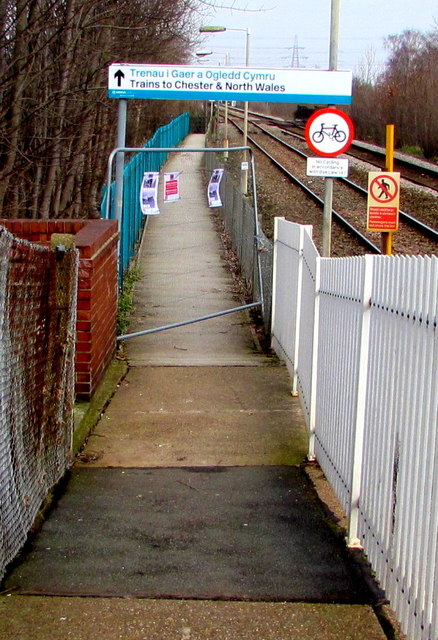
Image: © Jaggery Taken: 22 Feb 2018
Viewed on February 22nd 2018. A temporary barrier is across the path from Shotton High Level station on the Broderlands Line to Shotton Low Level station on the North Wales Coast Line. A nearby Network Rail notice dated December 14th 2017 states that work to replace the longitudinal timbers and slip resistant walkboards on the Shotton Low Level link bridge is scheduled to take place from January 22nd 2018 until February 16th 2018. This photo was taken six days after the scheduled end of the work. I don't know when the path reopened.
Images are licensed for reuse under creativecommons.org/licenses/by-sa/2.0
Image Location

Latitude
53.212994
Longitude
-3.037836