Ibrox Stadium from the air
Introduction
The photograph on this page of Ibrox Stadium from the air by Thomas Nugent as part of the Geograph project.
The Geograph project started in 2005 with the aim of publishing, organising and preserving representative images for every square kilometre of Great Britain, Ireland and the Isle of Man.

There are currently over 7.5m images from over 14,400 individuals and you can help contribute to the project by visiting https://www.geograph.org.uk
Ibrox Stadium from the air
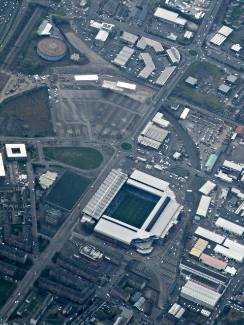
Image: © Thomas Nugent Taken: 15 Apr 2019
Home of Rangers FC. The route of the former Princes Dock Joint Railway can be seen curving around the stadium, joining the existing main line from Glasgow to Paisley at the top left corner of the photo, where Helen Street gas works can also be seen. The car park between the stadium and the gas works is the site of the former Albion greyhound racing track.
Images are licensed for reuse under creativecommons.org/licenses/by-sa/2.0
Image Location
Latitude
55.851982
Longitude
-4.309821