Welfare Hall, Merthyr Road, Tafarnaubach
Introduction
The photograph on this page of Welfare Hall, Merthyr Road, Tafarnaubach by Jaggery as part of the Geograph project.
The Geograph project started in 2005 with the aim of publishing, organising and preserving representative images for every square kilometre of Great Britain, Ireland and the Isle of Man.

There are currently over 7.5m images from over 14,400 individuals and you can help contribute to the project by visiting https://www.geograph.org.uk
Welfare Hall, Merthyr Road, Tafarnaubach
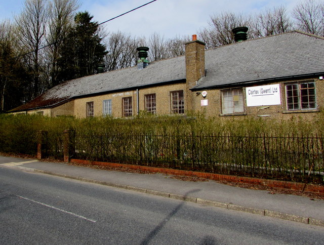
Image: © Jaggery Taken: 15 Apr 2019
Coflein records that Tafarnaubach & Princetown Miners' Welfare Hall opened in 1937 as a branch of the Tredegar Workmen's Institute. Funded through a grant from the Miners' Welfare Fund, the hall provided facilities typical of workmen's institutes of that period.
Images are licensed for reuse under creativecommons.org/licenses/by-sa/2.0
Image Location
Latitude
51.783946
Longitude
-3.278851