OS benchmark - Church End, barn on Shawbury Lane
Introduction
The photograph on this page of OS benchmark - Church End, barn on Shawbury Lane by Richard Law as part of the Geograph project.
The Geograph project started in 2005 with the aim of publishing, organising and preserving representative images for every square kilometre of Great Britain, Ireland and the Isle of Man.

There are currently over 7.5m images from over 14,400 individuals and you can help contribute to the project by visiting https://www.geograph.org.uk
OS benchmark - Church End, barn on Shawbury Lane
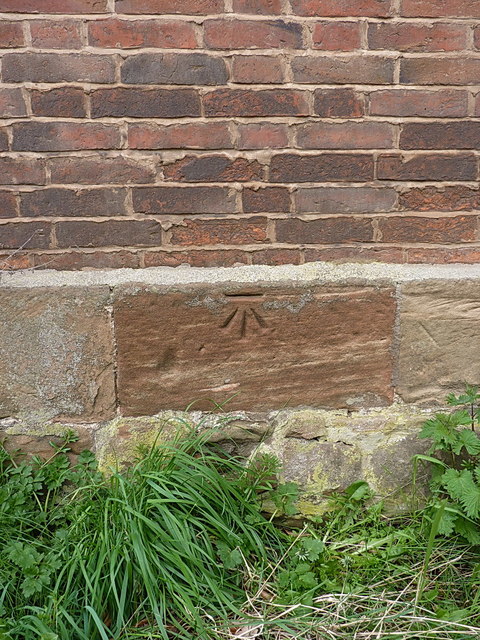
Image: © Richard Law Taken: 11 Apr 2019
An OS cutmark on the stone plinth of an old barn near The Old Rectory outbuildings, which was originally levelled in 1964 at 108.78m above Ordnance Datum Newlyn.
Images are licensed for reuse under creativecommons.org/licenses/by-sa/2.0
Image Location
Latitude
52.514396
Longitude
-1.643207