Former Camfa-Rhinallt Turnpike House by the A5104
Introduction
The photograph on this page of Former Camfa-Rhinallt Turnpike House by the A5104 by Milestone Society as part of the Geograph project.
The Geograph project started in 2005 with the aim of publishing, organising and preserving representative images for every square kilometre of Great Britain, Ireland and the Isle of Man.

There are currently over 7.5m images from over 14,400 individuals and you can help contribute to the project by visiting https://www.geograph.org.uk
Former Camfa-Rhinallt Turnpike House by the A5104
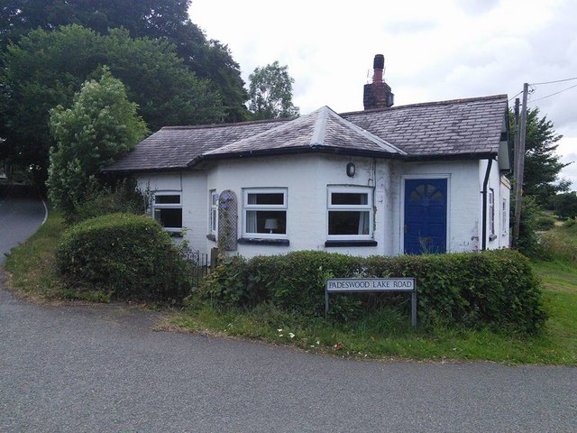
Image: © Milestone Society Taken: Unknown
Camfa-Rhinallt Toll House by the A5104, in parish of Nercwys (Flintshire District), Toll Bar Cottage, Chester Road junction with Padeswood Lake Road. To be surveyed Milestone Society National ID: FLT.NER
Images are licensed for reuse under creativecommons.org/licenses/by-sa/2.0
Image Location
Latitude
53.142786
Longitude
-3.069482