Old Toll House by the B6433, Rowley Lane, Lepton
Introduction
The photograph on this page of Old Toll House by the B6433, Rowley Lane, Lepton by Milestone Society as part of the Geograph project.
The Geograph project started in 2005 with the aim of publishing, organising and preserving representative images for every square kilometre of Great Britain, Ireland and the Isle of Man.

There are currently over 7.5m images from over 14,400 individuals and you can help contribute to the project by visiting https://www.geograph.org.uk
Old Toll House by the B6433, Rowley Lane, Lepton
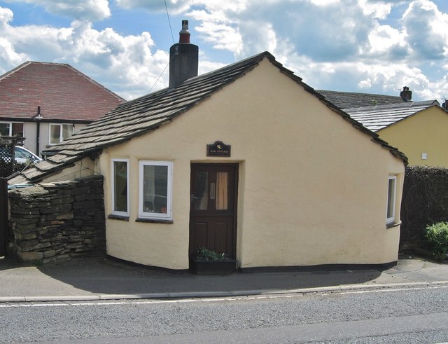
Image: © Milestone Society Taken: Unknown
Lepton (High Gate) by the B6433, in parish of Kirkburton (Kirklees District), Bar Cottage, Rowley Lane, Lepton. West Yorkshire Archaeology Advisory Service (WYAAS) WYHER number: MWY7588 https://www.heritagegateway.org.uk/Gateway/Results_Single.aspx?uid=MWY7588&resourceID=105 To be surveyed Milestone Society National ID: YW.HUD02
Images are licensed for reuse under creativecommons.org/licenses/by-sa/2.0
Image Location
Latitude
53.631291
Longitude
-1.705509