Exebridge Tollhouse by the A396 crossroads
Introduction
The photograph on this page of Exebridge Tollhouse by the A396 crossroads by Alan Rosevear as part of the Geograph project.
The Geograph project started in 2005 with the aim of publishing, organising and preserving representative images for every square kilometre of Great Britain, Ireland and the Isle of Man.

There are currently over 7.5m images from over 14,400 individuals and you can help contribute to the project by visiting https://www.geograph.org.uk
Exebridge Tollhouse by the A396 crossroads
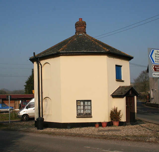
Image: © Alan Rosevear Taken: 18 Feb 2008
Toll House by the A396, in the parish of Morebath (Mid Devon District), The Toll-house, Higher Grants Farm, Exebridge, TA22 9BD. Grade II listed. List Entry Number: 1106897 https://historicengland.org.uk/listing/the-list/list-entry/1106897 Surveyed Milestone Society National ID: DV.MOB
Images are licensed for reuse under creativecommons.org/licenses/by-sa/2.0
Image Location
Latitude
51.007793
Longitude
-3.522437