Old Toll House by Clee Hill Road, Burford
Introduction
The photograph on this page of Old Toll House by Clee Hill Road, Burford by Milestone Society as part of the Geograph project.
The Geograph project started in 2005 with the aim of publishing, organising and preserving representative images for every square kilometre of Great Britain, Ireland and the Isle of Man.

There are currently over 7.5m images from over 14,400 individuals and you can help contribute to the project by visiting https://www.geograph.org.uk
Old Toll House by Clee Hill Road, Burford
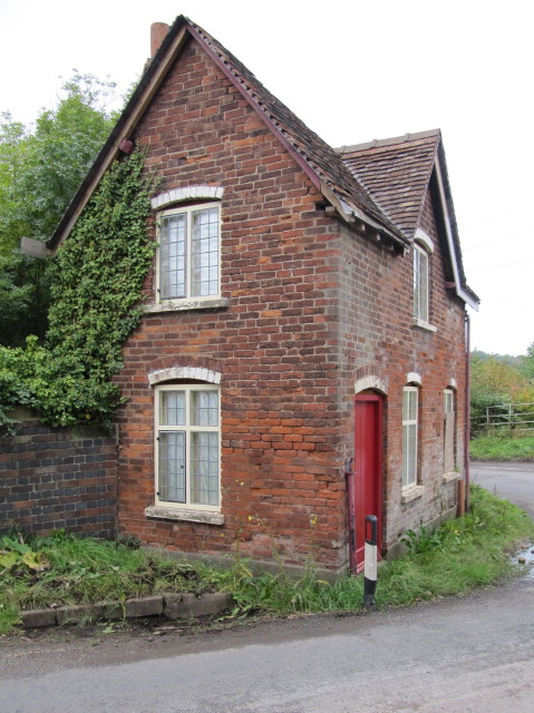
Image: © Milestone Society Taken: Unknown
Toll House in the parish of Burford, Harp Bank or Signalman's Cottage, Clee Hill Road (B4214). Grade II listed. List Entry Number: 1383430 https://historicengland.org.uk/listing/the-list/list-entry/1383430 To be surveyed Milestone Society National ID: SA.BUR02
Images are licensed for reuse under creativecommons.org/licenses/by-sa/2.0
Image Location


Leaflet Map data © OpenStreetMap
Latitude
52.317818
Longitude
-2.598708