Old Toll House, Chirbury
Introduction
The photograph on this page of Old Toll House, Chirbury by Milestone Society as part of the Geograph project.
The Geograph project started in 2005 with the aim of publishing, organising and preserving representative images for every square kilometre of Great Britain, Ireland and the Isle of Man.

There are currently over 7.5m images from over 14,400 individuals and you can help contribute to the project by visiting https://www.geograph.org.uk
Old Toll House, Chirbury
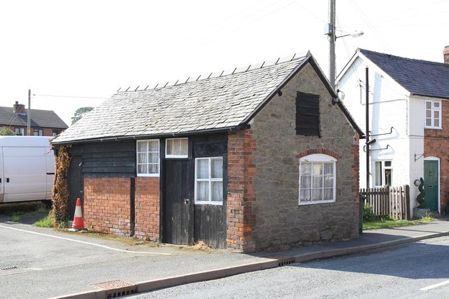
Image: © Milestone Society Taken: Unknown
Toll House in the parish of Chirbury with Brompton, (B4386), by the car park opposite the village hall, near the junction with Horseshoe Road. Recorded as a stable and pigsty by Shropshire County Council. Shropshire HER. HER Number (PRN): 16434 https://www.heritagegateway.org.uk/Gateway/Results_Single.aspx?uid=MSA23191&resourceID=1015 Surveyed Milestone Society National ID: SA.CHI01
Images are licensed for reuse under creativecommons.org/licenses/by-sa/2.0
Image Location
Latitude
52.578315
Longitude
-3.090384