Old Milepost by the B526, High Street, Stoke Goldington
Introduction
The photograph on this page of Old Milepost by the B526, High Street, Stoke Goldington by Milestone Society as part of the Geograph project.
The Geograph project started in 2005 with the aim of publishing, organising and preserving representative images for every square kilometre of Great Britain, Ireland and the Isle of Man.

There are currently over 7.5m images from over 14,400 individuals and you can help contribute to the project by visiting https://www.geograph.org.uk
Old Milepost by the B526, High Street, Stoke Goldington
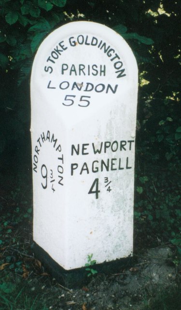
Image: © Milestone Society Taken: Unknown
Bucks. pressing by the B526, in parish of Stoke Goldington (Milton Keynes District), High Street; 200m South of Church Lane junction, North West of Stoke Goldington Village, on wide well cut grass verge, under trees and bushes. Lost since 2005. Inscription reads:- : NORTHAMPTON / 9¾ : : STOKE GOLDINGTON / PARISH / LONDON / 55 : : NEWPORT / PAGNELL / 4¾ : Milestone Society National ID: BU_npnh05
Images are licensed for reuse under creativecommons.org/licenses/by-sa/2.0
Image Location
Latitude
52.136194
Longitude
-0.783098