Old Milestone by the A28, Island Road, Upstreet
Introduction
The photograph on this page of Old Milestone by the A28, Island Road, Upstreet by Alan Rosevear as part of the Geograph project.
The Geograph project started in 2005 with the aim of publishing, organising and preserving representative images for every square kilometre of Great Britain, Ireland and the Isle of Man.

There are currently over 7.5m images from over 14,400 individuals and you can help contribute to the project by visiting https://www.geograph.org.uk
Old Milestone by the A28, Island Road, Upstreet
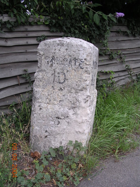
Image: © Alan Rosevear Taken: 9 Aug 2004
Ramsgate limestone diamond by the A28, in parish of Chislet (Canterbury District), Island Road, Upstreet, by No.145 on East edge of village, in grass between path and wooden fence and hedge to bungalow. Inscription reads:- : RAMSGATE / 10 : : LONDON / 62 : Kent HER. HER Number: TR 26 SW 195 https://www.heritagegateway.org.uk/Gateway/Results_Single.aspx?uid=MKE78174&resourceID=1005 Surveyed Milestone Society National ID: KE_RGCY10
Images are licensed for reuse under creativecommons.org/licenses/by-sa/2.0
Image Location
Latitude
51.325969
Longitude
1.203281