Old Toll House by the A267, Skippers Hill
Introduction
The photograph on this page of Old Toll House by the A267, Skippers Hill by Milestone Society as part of the Geograph project.
The Geograph project started in 2005 with the aim of publishing, organising and preserving representative images for every square kilometre of Great Britain, Ireland and the Isle of Man.

There are currently over 7.5m images from over 14,400 individuals and you can help contribute to the project by visiting https://www.geograph.org.uk
Old Toll House by the A267, Skippers Hill
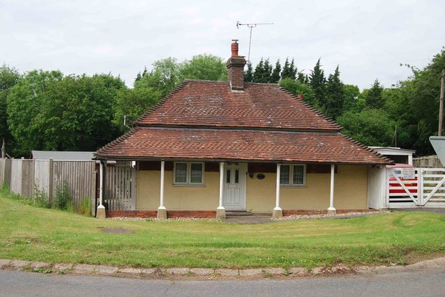
Image: © Milestone Society Taken: Unknown
Toll House by the A267 at its junction with Meres Lane, in the parish of Mayfield (Wealden District), Paygate, on Skippers Hill. East Sussex HER. HER Ref: MES35847 https://www.heritagegateway.org.uk/Gateway/Results_Single.aspx?uid=MES35847&resourceID=1026 Surveyed Milestone Society National ID: ES.MAF03
Images are licensed for reuse under creativecommons.org/licenses/by-sa/2.0
Image Location


Leaflet Map data © OpenStreetMap
Latitude
50.983982
Longitude
0.219472