The New River Islington N1
Introduction
The photograph on this page of The New River Islington N1 by Glyn Baker as part of the Geograph project.
The Geograph project started in 2005 with the aim of publishing, organising and preserving representative images for every square kilometre of Great Britain, Ireland and the Isle of Man.

There are currently over 7.5m images from over 14,400 individuals and you can help contribute to the project by visiting https://www.geograph.org.uk
The New River Islington N1
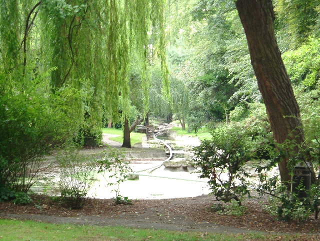
Image: © Glyn Baker Taken: 4 Oct 2005
This is the New River in Islington. The linear park along its banks was closed and the river rather dry due to repair work on the pumps on the day the picture was taken. The New River is a welcome strip of green in an otherwise totally built up area. The "New" river is in fact an aqueduct constructed for 40 miles along the 100 ft contour from the River Lea. It brought fresh water to London for the first time in 1613. The part of the river shown here is now purely ornamental.
Images are licensed for reuse under creativecommons.org/licenses/by-sa/2.0
Image Location
Latitude
51.544795
Longitude
-0.093509