No 1 Orchard Gardens, Teignmouth
Introduction
The photograph on this page of No 1 Orchard Gardens, Teignmouth by Robin Stott as part of the Geograph project.
The Geograph project started in 2005 with the aim of publishing, organising and preserving representative images for every square kilometre of Great Britain, Ireland and the Isle of Man.

There are currently over 7.5m images from over 14,400 individuals and you can help contribute to the project by visiting https://www.geograph.org.uk
No 1 Orchard Gardens, Teignmouth
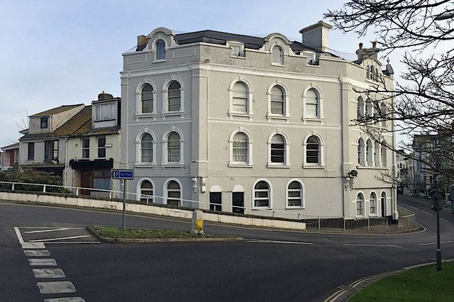
Image: © Robin Stott Taken: 10 Jan 2019
This large building, assumed to be flats, stands at the corner of modern Higher Brook Street, off to the left, and Orchard Gardens, right. The road immediately in front of the camera and the central frontage ought to be part of Fore Street Image: it joins Orchard Gardens out of shot right. From 1889 to 1955 old maps show this as three properties with a passage between the northernmost and Higher Brook Street. A map of 1971-89 shows no property boundaries and no passage. Best guess is that it was a hotel and bar that extended; it's not far from the station. There are cellar access covers in the footway below the right-hand frontage. 'No 1 Orchard Gardens' is a sign over a front door just round the corner https://www.geograph.org.uk/photo/6117302 ; no other numbering can be seen.
Images are licensed for reuse under creativecommons.org/licenses/by-sa/2.0
Image Location
Latitude
50.546947
Longitude
-3.497309