Former Whitefield Town Hall
Introduction
The photograph on this page of Former Whitefield Town Hall by Gerald England as part of the Geograph project.
The Geograph project started in 2005 with the aim of publishing, organising and preserving representative images for every square kilometre of Great Britain, Ireland and the Isle of Man.

There are currently over 7.5m images from over 14,400 individuals and you can help contribute to the project by visiting https://www.geograph.org.uk
Former Whitefield Town Hall
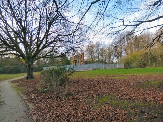
Image: © Gerald England Taken: 29 Dec 2018
The building was built around 1805 by Edward Barlow and originally named Green Hill. It was remodelled in 1857 and renamed Underlay. It became Whitefield Town Hall in 1933 until 1974. http://www.oocities.org/whitefieldudc/town-hall.html Since being vacated in the 1980s, it has been set on fire, vandalised and partly demolished. Only the south facade remains. Plans for a care home on the site have hung in the air for many years without resolution.
Images are licensed for reuse under creativecommons.org/licenses/by-sa/2.0
Image Location
Latitude
53.547839
Longitude
-2.295617