Stoke Bottom Lock, Stoke-on-Trent
Introduction
The photograph on this page of Stoke Bottom Lock, Stoke-on-Trent by Roger Kidd as part of the Geograph project.
The Geograph project started in 2005 with the aim of publishing, organising and preserving representative images for every square kilometre of Great Britain, Ireland and the Isle of Man.

There are currently over 7.5m images from over 14,400 individuals and you can help contribute to the project by visiting https://www.geograph.org.uk
Stoke Bottom Lock, Stoke-on-Trent
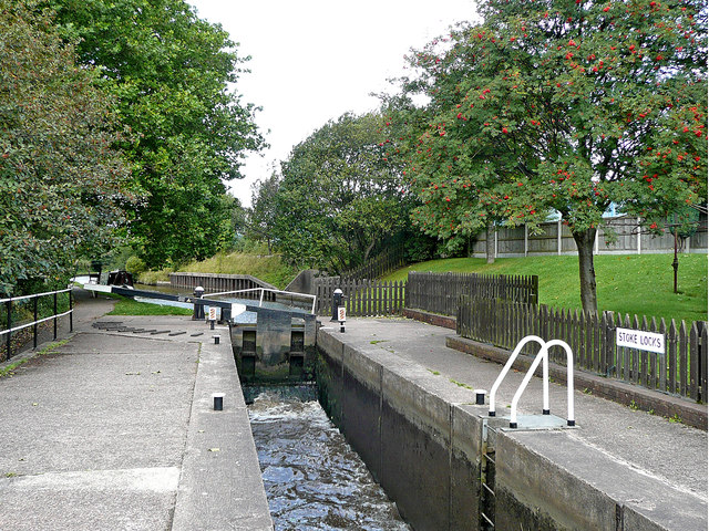
Image: © Roger Kidd Taken: 4 Sep 2009
The flight of five locks at Stoke-on-Trent (Trent and Mersey Canal) provide a rise of fifty feet (15·2 metres). In this image, both ground paddles are up, and water is rushing into the chamber.
Images are licensed for reuse under creativecommons.org/licenses/by-sa/2.0
Image Location
Latitude
53.010173
Longitude
-2.18596