Gatehouse to Friends Meeting House
Introduction
The photograph on this page of Gatehouse to Friends Meeting House by Ian Capper as part of the Geograph project.
The Geograph project started in 2005 with the aim of publishing, organising and preserving representative images for every square kilometre of Great Britain, Ireland and the Isle of Man.

There are currently over 7.5m images from over 14,400 individuals and you can help contribute to the project by visiting https://www.geograph.org.uk
Gatehouse to Friends Meeting House
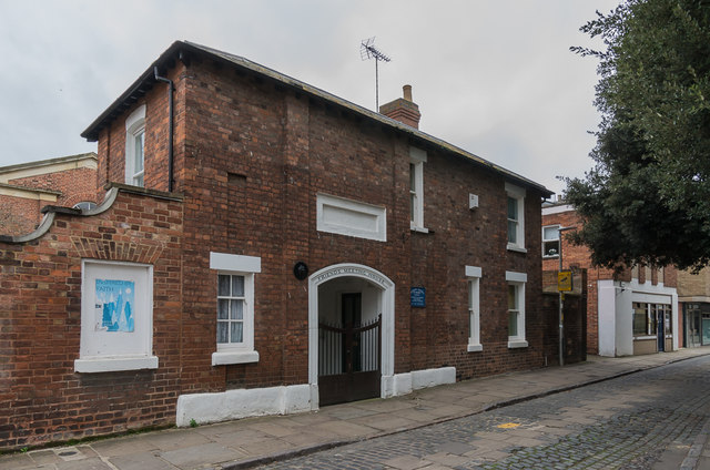
Image: © Ian Capper Taken: 16 Mar 2019
Gatehouse to the Friends Meeting House in Greyfriars, part of which is just visible on the left. Both date from the 1830s and are separately grade II listed - see www.historicengland.org.uk/listing/the-list/list-entry/1245829 for the gatehouse and www.historicengland.org.uk/listing/the-list/list-entry/1245828 for the meeting house.
Images are licensed for reuse under creativecommons.org/licenses/by-sa/2.0
Image Location
Latitude
51.863813
Longitude
-2.246916