Disused Railway, Seaham Harbour
Introduction
The photograph on this page of Disused Railway, Seaham Harbour by David Robinson as part of the Geograph project.
The Geograph project started in 2005 with the aim of publishing, organising and preserving representative images for every square kilometre of Great Britain, Ireland and the Isle of Man.

There are currently over 7.5m images from over 14,400 individuals and you can help contribute to the project by visiting https://www.geograph.org.uk
Disused Railway, Seaham Harbour
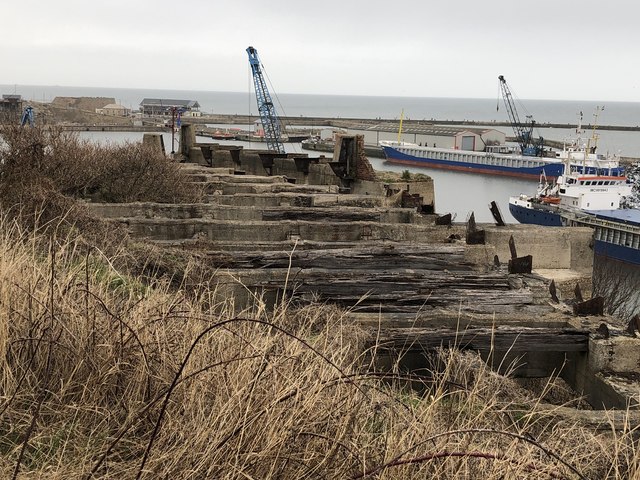
Image: © David Robinson Taken: 3 Mar 2019
Seaham harbour had an extensive and complicated railway system up until the second half of the 20th century. The railway operated on two levels, the upper level bringing in goods (primarily coal) for loading onto ships via staiths, while the lower level allowed access to the dockside. The image shows the remains of a gantry supporting railway sleepers at the southern end of the harbour for the upper level rail complex.
Images are licensed for reuse under creativecommons.org/licenses/by-sa/2.0
Image Location
Latitude
54.833513
Longitude
-1.327278