Dolaugwyn
Introduction
The photograph on this page of Dolaugwyn by Eirian Evans as part of the Geograph project.
The Geograph project started in 2005 with the aim of publishing, organising and preserving representative images for every square kilometre of Great Britain, Ireland and the Isle of Man.

There are currently over 7.5m images from over 14,400 individuals and you can help contribute to the project by visiting https://www.geograph.org.uk
Dolaugwyn
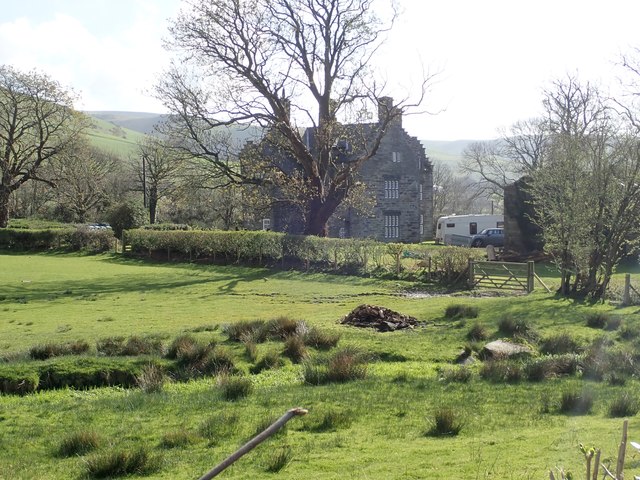
Image: © Eirian Evans Taken: 26 Mar 2019
The farm is on flat land of the lower Afon Fathew valley, to the west of Bryn Crug village and stands apart to the west of the farm buildings. The house was built a little before 1620 by Lewis and Anne Gwynne. It is Grade II* listed.
Images are licensed for reuse under creativecommons.org/licenses/by-sa/2.0
Image Location
Latitude
52.611592
Longitude
-4.034979