Church on Vaughan Street, North Skelton
Introduction
The photograph on this page of Church on Vaughan Street, North Skelton by Stephen McCulloch as part of the Geograph project.
The Geograph project started in 2005 with the aim of publishing, organising and preserving representative images for every square kilometre of Great Britain, Ireland and the Isle of Man.

There are currently over 7.5m images from over 14,400 individuals and you can help contribute to the project by visiting https://www.geograph.org.uk
Church on Vaughan Street, North Skelton
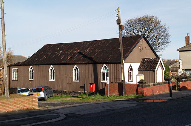
Image: © Stephen McCulloch Taken: 12 Nov 2007
Foundation Christian Fellowship Pentecostal Church. This church is made from corrugated iron. North Skelton war memorial can be seen on the right of the picture. Further information provided by John Webb: These 'Tin Tabernacle' churches, as they were frequently nicknamed, were always constructed of corrugated iron on a timber framework. They were often made 'off the peg' by a number of companies who then sent out the component parts, or sometimes partly prefabricated, for erection on site. Few now remain in church use, and many are preserved in various open-air museums or similar sites. They predominately come from the mid-Victorian period and were used where industrial villages and towns sprung up remote from the already established town/village churches.
Images are licensed for reuse under creativecommons.org/licenses/by-sa/2.0
Image Location
Latitude
54.557706
Longitude
-0.958852