The Swale in flood
Introduction
The photograph on this page of The Swale in flood by Gordon Hatton as part of the Geograph project.
The Geograph project started in 2005 with the aim of publishing, organising and preserving representative images for every square kilometre of Great Britain, Ireland and the Isle of Man.

There are currently over 7.5m images from over 14,400 individuals and you can help contribute to the project by visiting https://www.geograph.org.uk
The Swale in flood
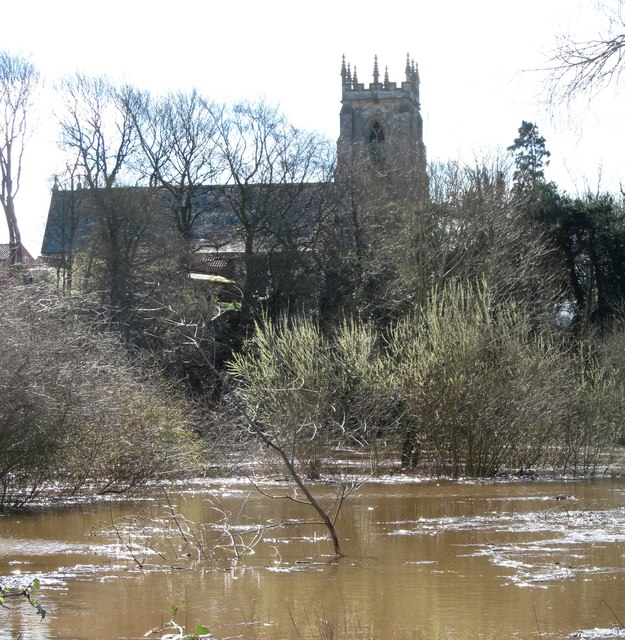
Image: © Gordon Hatton Taken: 17 Mar 2019
Flooding along the lower Swale is not uncommon, but this was the first time the river had burst its banks through the winter/spring of 2018/19 causing the A684 to be closed further upstream at Morton on Swale. This followed one wet day in the local area, but several wet days combined with a little snow melt in Swaledale. The view is towards St Columba's Church.
Images are licensed for reuse under creativecommons.org/licenses/by-sa/2.0
Image Location


Leaflet Map data © OpenStreetMap
Latitude
54.178866
Longitude
-1.389575