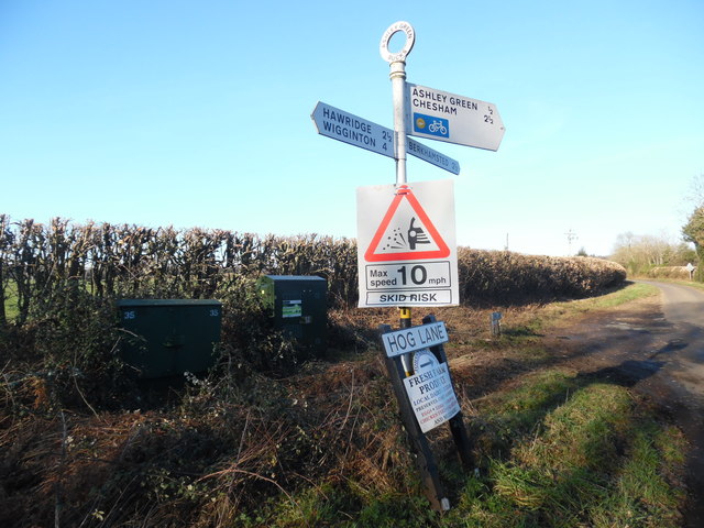
Signpost near Ashley Green, Bucks
Introduction
The photograph on this page of Signpost near Ashley Green, Bucks by David Hillas as part of the Geograph project.
The Geograph project started in 2005 with the aim of publishing, organising and preserving representative images for every square kilometre of Great Britain, Ireland and the Isle of Man.
There are currently over 7.5m images from over 14,400 individuals and you can help contribute to the project by visiting https://www.geograph.org.uk

Image: © David Hillas Taken: 21 Feb 2019
This photo shows the signpost at the junction of Hog Land and Johns Lane north west of Ashley Green. It shows the following nearby places and distances, Ashley Green ½ mile, Berkhamsted 2½ miles, Chesham 2½ miles, Hawridge 2½ miles and Wigginton 4 miles. Below the signpost directions is a temporary roadsign indicating loose chippings on the road with a maximum speed limit of 10 mph due to skid risk. Behind the signpost can be seen two dark green BT cabinets, the newer one on the right containing fibre optic equipment.

