Former Tollhouse by the A470 in Llanrwst
Introduction
The photograph on this page of Former Tollhouse by the A470 in Llanrwst by Milestone Society as part of the Geograph project.
The Geograph project started in 2005 with the aim of publishing, organising and preserving representative images for every square kilometre of Great Britain, Ireland and the Isle of Man.

There are currently over 7.5m images from over 14,400 individuals and you can help contribute to the project by visiting https://www.geograph.org.uk
Former Tollhouse by the A470 in Llanrwst
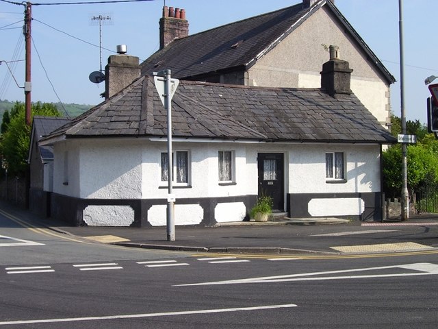
Image: © Milestone Society Taken: Unknown
Tafarn y Fedw (Brynamlwg) by the A470, in parish of Llanrwst (Conwy District), Tollhouse (Brynamlwg) Borthdy (formerly a ruin by roadside), Ffordd Berth Ddu (Betws Road) junction with Ffordd Cae'r Melwr (Nebo Road) (Lledr Cottage), LL26 0HL. Grade II listed by Cadw. Reference Number: 3585 https://cadwpublic-api.azurewebsites.net/reports/listedbuilding/FullReport?lang=&id=3585 To be surveyed Milestone Society National ID: CON.LRW01
Images are licensed for reuse under creativecommons.org/licenses/by-sa/2.0
Image Location
Latitude
53.135367
Longitude
-3.792776