Direction Sign - Signpost by the A39/B3266 junction
Introduction
The photograph on this page of Direction Sign - Signpost by the A39/B3266 junction by Milestone Society as part of the Geograph project.
The Geograph project started in 2005 with the aim of publishing, organising and preserving representative images for every square kilometre of Great Britain, Ireland and the Isle of Man.

There are currently over 7.5m images from over 14,400 individuals and you can help contribute to the project by visiting https://www.geograph.org.uk
Direction Sign - Signpost by the A39/B3266 junction
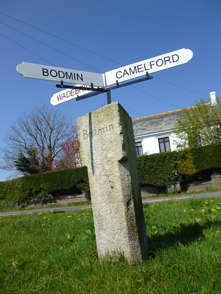
Image: © Milestone Society Taken: Unknown
Finial; Granite post and fingers by the A39, in parish of Camelford (North Cornwall District), Brunswick, Valley Truckle, junction with the B3266. Grade II listed. List Entry Number: 1143561 https://historicengland.org.uk/listing/the-list/list-entry/1143561 To be surveyed Milestone Society National ID: CW_SX0982
Images are licensed for reuse under creativecommons.org/licenses/by-sa/2.0
Image Location


Leaflet Map data © OpenStreetMap
Latitude
50.611045
Longitude
-4.687856