Direction Sign - Signpost at High Cross, Poulton-Le-Fylde
Introduction
The photograph on this page of Direction Sign - Signpost at High Cross, Poulton-Le-Fylde by Milestone Society as part of the Geograph project.
The Geograph project started in 2005 with the aim of publishing, organising and preserving representative images for every square kilometre of Great Britain, Ireland and the Isle of Man.

There are currently over 7.5m images from over 14,400 individuals and you can help contribute to the project by visiting https://www.geograph.org.uk
Direction Sign - Signpost at High Cross, Poulton-Le-Fylde
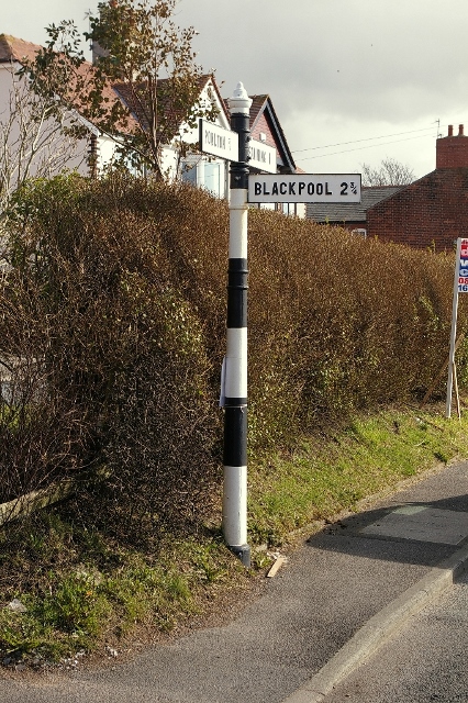
Image: © Milestone Society Taken: Unknown
Nipple finial - 3 arms; by the B5266, in parish of Staining (Fylde District), Normoss Road junction with Staining Old Road. To be surveyed Milestone Society National ID: LA_SD3437
Images are licensed for reuse under creativecommons.org/licenses/by-sa/2.0
Image Location
Latitude
53.830115
Longitude
-2.993945