Old Milepost north of Temple Sowerby
Introduction
The photograph on this page of Old Milepost north of Temple Sowerby by CF Smith as part of the Geograph project.
The Geograph project started in 2005 with the aim of publishing, organising and preserving representative images for every square kilometre of Great Britain, Ireland and the Isle of Man.

There are currently over 7.5m images from over 14,400 individuals and you can help contribute to the project by visiting https://www.geograph.org.uk
Old Milepost north of Temple Sowerby
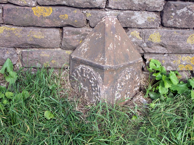
Image: © CF Smith Taken: 6 Dec 2009
Cast iron post by the former A66, in parish of Temple Sowerby (Eden District), opposite large farm yard (West View) on North West edge of village, on grass against stone wall, on North East side of road. Appleby plate, erected by the Brough & Eamont Bridge turnpike trust in the 19th century. Inscription reads:- : APPLEBY / 7 / MILES : : PENRITH / 6 / MILES : Milestone Society National ID: WE_PRAP06
Images are licensed for reuse under creativecommons.org/licenses/by-sa/2.0
Image Location
Latitude
54.640585
Longitude
-2.607647