Direction Sign - Signpost 'To Barnston', by Whitfield Lane
Introduction
The photograph on this page of Direction Sign - Signpost 'To Barnston', by Whitfield Lane by John S Turner as part of the Geograph project.
The Geograph project started in 2005 with the aim of publishing, organising and preserving representative images for every square kilometre of Great Britain, Ireland and the Isle of Man.

There are currently over 7.5m images from over 14,400 individuals and you can help contribute to the project by visiting https://www.geograph.org.uk
Direction Sign - Signpost 'To Barnston', by Whitfield Lane
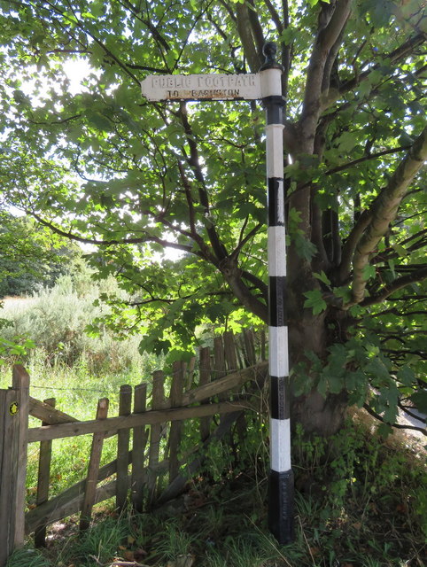
Image: © John S Turner Taken: 17 Sep 2016
Ball finial - 1 arm; Wirral Footpath post by the UC road, in parish of Heswall (Wirral District), North East side of Whitfield Lane and just East of Heswall Primary School. Column inscription reads:- : ERECTED BY THE WIRRAL FOOTPATHS ECT(sic) SOCIETY WITH CONSENT OF THE COUNTY COUNCIL : Plate inscription reads:- : PUBLIC FOOTPATH / TO BARNSTON : Merseyside HER. Reference: MME15988 https://www.heritagegateway.org.uk/Gateway/Results_Single.aspx?uid=3314089&resourceID=1970 Surveyed Milestone Society National ID: CH_SJ2782
Images are licensed for reuse under creativecommons.org/licenses/by-sa/2.0
Image Location
Latitude
53.332648
Longitude
-3.09034