Old Milestone by the B3284, east of Park Hoskyn
Introduction
The photograph on this page of Old Milestone by the B3284, east of Park Hoskyn by Ian Thompson as part of the Geograph project.
The Geograph project started in 2005 with the aim of publishing, organising and preserving representative images for every square kilometre of Great Britain, Ireland and the Isle of Man.

There are currently over 7.5m images from over 14,400 individuals and you can help contribute to the project by visiting https://www.geograph.org.uk
Old Milestone by the B3284, east of Park Hoskyn
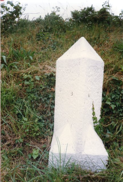
Image: © Ian Thompson Taken: Unknown
Stone post (plates lost) by the B3284, in parish of Perranzabuloe (Carrick District), Park Hoskyn, by the road, on West side of road. Erected by the Local Highways Board in the 19th century. Inscription once read:- : (PERRANPORTH / 3) : : (TRURO / 6) : Cornwall & Scilly HER. HER Number: 178084 https://www.heritagegateway.org.uk/Gateway/Results_Single.aspx?uid=MCO53861&resourceID=1020 More recent photo after replica plates made and fitted https://www.geograph.org.uk/photo/6402983 Milestone Society National ID: CW_TOPP06
Images are licensed for reuse under creativecommons.org/licenses/by-sa/2.0
Image Location
Latitude
50.303953
Longitude
-5.1538