The River Meden
Introduction
The photograph on this page of The River Meden by Alan Walker as part of the Geograph project.
The Geograph project started in 2005 with the aim of publishing, organising and preserving representative images for every square kilometre of Great Britain, Ireland and the Isle of Man.

There are currently over 7.5m images from over 14,400 individuals and you can help contribute to the project by visiting https://www.geograph.org.uk
The River Meden
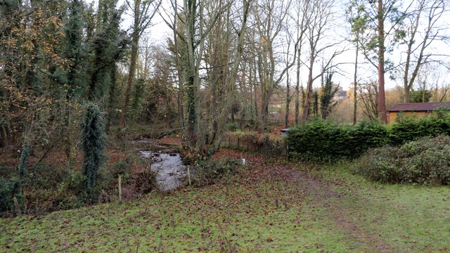
Image: © Alan Walker Taken: 4 Dec 2017
The photograph shows a public footpath running by the side of the River Meden. Behind the viewpoint the footpath leads into an area known as Little Matlock. Ahead the footpath crosses a road leading, to the right, St Chads Church and Pleasley Vale. To the left, the road becomes a private track leading to Image Crossing the road the footpath passes through some scrubland before reaching a meadow beyond which it joins the road through Pleasley Vale. In the meadow there is a junction with a Image *** To see a photograph taken from the point where the public footpath crosses the road ahead, click here:- Image
Images are licensed for reuse under creativecommons.org/licenses/by-sa/2.0
Image Location
Latitude
53.180847
Longitude
-1.212601