Old Milestone, North East of Lower Whatley
Introduction
The photograph on this page of Old Milestone, North East of Lower Whatley by JR Dowding as part of the Geograph project.
The Geograph project started in 2005 with the aim of publishing, organising and preserving representative images for every square kilometre of Great Britain, Ireland and the Isle of Man.

There are currently over 7.5m images from over 14,400 individuals and you can help contribute to the project by visiting https://www.geograph.org.uk
Old Milestone, North East of Lower Whatley
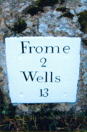
Image: © JR Dowding Taken: 13 Sep 2012
The milestone is located on the road to Egford,400m from Lower Whatley, on the verge in front of the hedge on the south side of road. Parish of Whatley (Mendip District). Metal plate attached to stone post, Frome square iron plate design, erected by the Frome turnpike trust in the 18th century. Inscription reads:- FROME / 2 / WELLS / 13 Grade II Listed, List Entry Number: 1058264 https://historicengland.org.uk/listing/the-list/list-entry/1058264 Milestone Society National ID: SO_FRWL02
Images are licensed for reuse under creativecommons.org/licenses/by-sa/2.0
Image Location


Leaflet Map data © OpenStreetMap
Latitude
51.226483
Longitude
-2.364124