Remains of Ladywell Cross by the former A30, Sticklepath
Introduction
The photograph on this page of Remains of Ladywell Cross by the former A30, Sticklepath by Alan Rosevear as part of the Geograph project.
The Geograph project started in 2005 with the aim of publishing, organising and preserving representative images for every square kilometre of Great Britain, Ireland and the Isle of Man.

There are currently over 7.5m images from over 14,400 individuals and you can help contribute to the project by visiting https://www.geograph.org.uk
Remains of Ladywell Cross by the former A30, Sticklepath
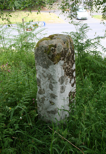
Image: © Alan Rosevear Taken: 19 Jun 2010
Ladywell Cross, old shaft by the UC Road (was A30), in parish of Sticklepath (West Devon District), junction with a lane that leads to the hamlet of Skaigh, 110m Northwest of St Mary's church, very high on a bank above the junction, amongst bushes. Scheduled Monument. List Entry Number: 1019216 https://historicengland.org.uk/listing/the-list/list-entry/1019216 Surveyed Milestone Society National ID: DVWD_STI01
Images are licensed for reuse under creativecommons.org/licenses/by-sa/2.0
Image Location
Latitude
50.73084
Longitude
-3.930029