Old Milestone in Lasham, Herriard parish
Introduction
The photograph on this page of Old Milestone in Lasham, Herriard parish by K Lawrence as part of the Geograph project.
The Geograph project started in 2005 with the aim of publishing, organising and preserving representative images for every square kilometre of Great Britain, Ireland and the Isle of Man.

There are currently over 7.5m images from over 14,400 individuals and you can help contribute to the project by visiting https://www.geograph.org.uk
Old Milestone in Lasham, Herriard parish
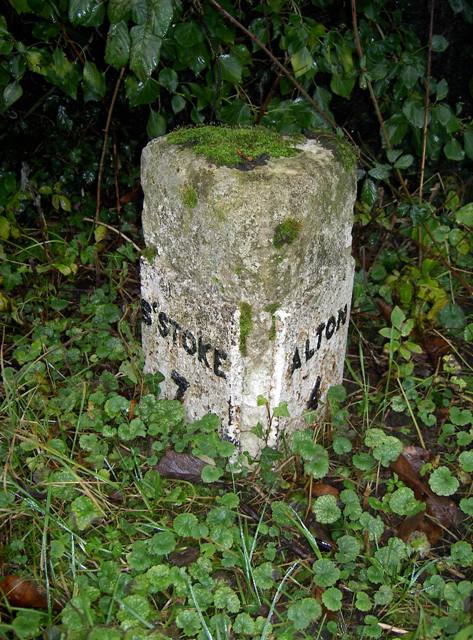
Image: © K Lawrence Taken: 21 Dec 2002
Metal plate attached to stone post by the UC road, in parish of Herriard (Basingstoke and Deane District), Lasham, on grass verge at road junction, on West side of road. Candover block, erected by the Basingstoke, Preston Candover & Alton turnpike trust in the 19th century. Inscription reads:- : B'STOKE / 7 : : ALTON / 4 : Grade II listed. List Entry Number: 1391750 https://historicengland.org.uk/listing/the-list/list-entry/1391750 Milestone Society National ID: HA_BAAL07
Images are licensed for reuse under creativecommons.org/licenses/by-sa/2.0
Image Location


Leaflet Map data © OpenStreetMap
Latitude
51.176688
Longitude
-1.0355