Entrance to the former Lichfield Brewery site, Lichfield
Introduction
The photograph on this page of Entrance to the former Lichfield Brewery site, Lichfield by Jaggery as part of the Geograph project.
The Geograph project started in 2005 with the aim of publishing, organising and preserving representative images for every square kilometre of Great Britain, Ireland and the Isle of Man.

There are currently over 7.5m images from over 14,400 individuals and you can help contribute to the project by visiting https://www.geograph.org.uk
Entrance to the former Lichfield Brewery site, Lichfield
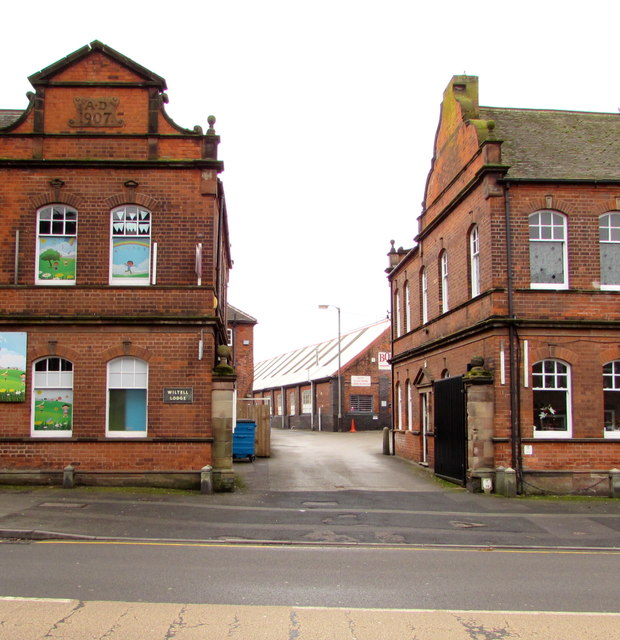
Image: © Jaggery Taken: 17 Feb 2018
From the A51 Upper St John Street viewed in February 2018. Production at the brewery ceased in the early 1930s. The building on the left is Wiltell Lodge. https://www.geograph.org.uk/photo/6098715 The former brewery office https://www.geograph.org.uk/photo/6098721 is on the right.
Images are licensed for reuse under creativecommons.org/licenses/by-sa/2.0
Image Location
Latitude
52.678933
Longitude
-1.826904