Old Direction Sign - Signpost near Jericho
Introduction
The photograph on this page of Old Direction Sign - Signpost near Jericho by M Hatton as part of the Geograph project.
The Geograph project started in 2005 with the aim of publishing, organising and preserving representative images for every square kilometre of Great Britain, Ireland and the Isle of Man.

There are currently over 7.5m images from over 14,400 individuals and you can help contribute to the project by visiting https://www.geograph.org.uk
Old Direction Sign - Signpost near Jericho
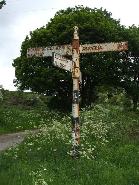
Image: © M Hatton Taken: 1 Jan 2014
Pawn finial - 4 arms; Cumberland CC square end by the UC road near Jericho, in parish of Holme St Cuthbert (Allerdale District). By 2023 the HOLME ST CUTHBERT ¾ / MAWBRAY 2 arm had been lost, see https://www.geograph.org.uk/photo/7601249. To be surveyed Milestone Society National ID: CU_NY1146
Images are licensed for reuse under creativecommons.org/licenses/by-sa/2.0
Image Location
Latitude
54.804633
Longitude
-3.381295