Old Milestone by the A38, Woodford, Alkington parish
Introduction
The photograph on this page of Old Milestone by the A38, Woodford, Alkington parish by M Faherty as part of the Geograph project.
The Geograph project started in 2005 with the aim of publishing, organising and preserving representative images for every square kilometre of Great Britain, Ireland and the Isle of Man.

There are currently over 7.5m images from over 14,400 individuals and you can help contribute to the project by visiting https://www.geograph.org.uk
Old Milestone by the A38, Woodford, Alkington parish
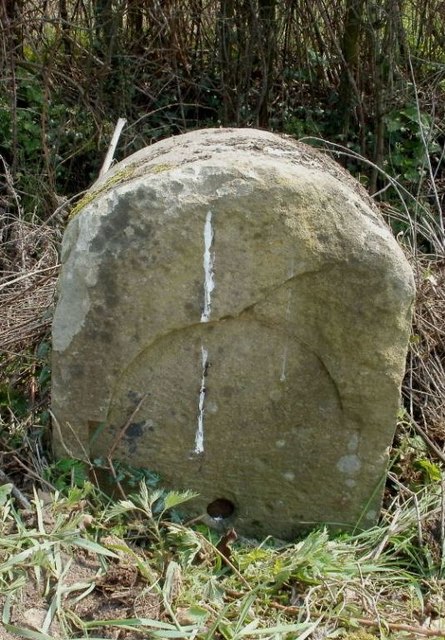
Image: © M Faherty Taken: 12 Apr 2010
Stone post (plate lost) by the A38, in parish of Alkington (Stroud District), Woodford, by 30mph and village sign on verge, on Southeast side of road. Erected by the Berkley & Dursley (Division) turnpike trust in the 19th century. Inscription reads:- (Gloucester 17) (Bristol 17) Milestone Society National ID: GL_GLBR17
Images are licensed for reuse under creativecommons.org/licenses/by-sa/2.0
Image Location
Latitude
51.663365
Longitude
-2.442972