Old Milestone by Tenterden Road, Biddenden parish
Introduction
The photograph on this page of Old Milestone by Tenterden Road, Biddenden parish by C Woodward as part of the Geograph project.
The Geograph project started in 2005 with the aim of publishing, organising and preserving representative images for every square kilometre of Great Britain, Ireland and the Isle of Man.

There are currently over 7.5m images from over 14,400 individuals and you can help contribute to the project by visiting https://www.geograph.org.uk
Old Milestone by Tenterden Road, Biddenden parish
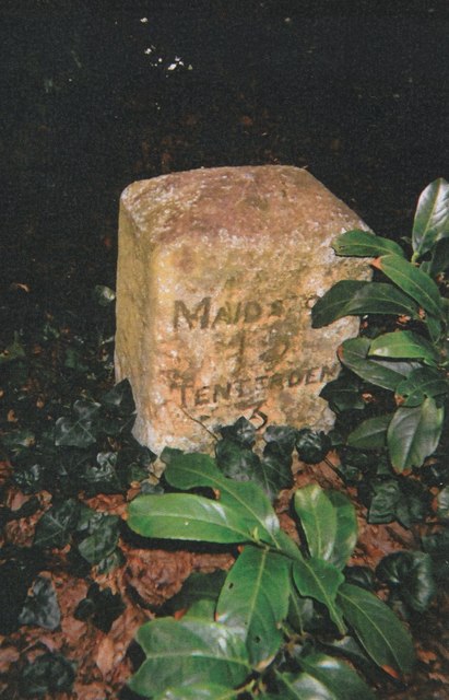
Image: © C Woodward Taken: 9 May 2013
Carved stone post by the UC road, in parish of Biddenden (Ashford District), Tenterden Road, South of "Castleton's Oak" PH, near Brogues Wood, just North of gate, in shrubbery with ivy cover, on West side of road. Biddenden stone, erected by the Biddenden turnpike trust in the 19th century. Inscription reads:- MAIDSTONE 15 TENTERDEN 3 Rivet benchmark on top. Milestone Society National ID: KE_MDTD15
Images are licensed for reuse under creativecommons.org/licenses/by-sa/2.0
Image Location
Latitude
51.089949
Longitude
0.63698