Old Milestone by the A10, Ermine Street, Chipping Hill, Buckland
Introduction
The photograph on this page of Old Milestone by the A10, Ermine Street, Chipping Hill, Buckland by MW Hallett as part of the Geograph project.
The Geograph project started in 2005 with the aim of publishing, organising and preserving representative images for every square kilometre of Great Britain, Ireland and the Isle of Man.

There are currently over 7.5m images from over 14,400 individuals and you can help contribute to the project by visiting https://www.geograph.org.uk
Old Milestone by the A10, Ermine Street, Chipping Hill, Buckland
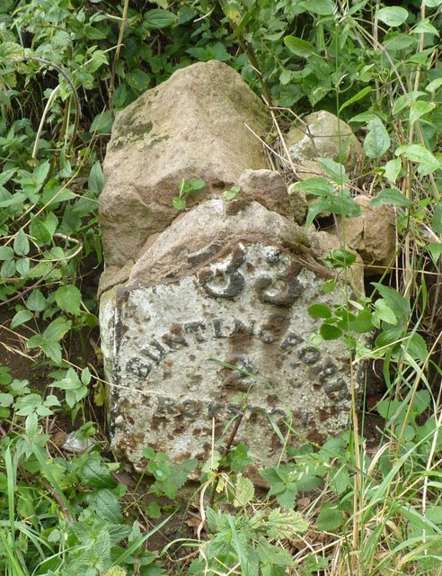
Image: © MW Hallett Taken: 11 Aug 2002
Metal plate attached to stone post by the A10, in parish of Buckland (East Hertfordshire District), Chipping Hill, North of Chipping, on the verge, on West side of road. Wadesmill plate, erected by the Wadesmill turnpike trust in the 19th century. Stone and plate badly broken. Inscription reads:- (LONDON) 33 BUNTINGFORD 2 Royston 5 Hertfordshire HER & St Albans UAD. HHER Number: 5044 https://www.heritagegateway.org.uk/Gateway/Results_Single.aspx?uid=MHT5044&resourceID=1008 Milestone Society National ID: HE_LK33
Images are licensed for reuse under creativecommons.org/licenses/by-sa/2.0
Image Location
Latitude
51.973194
Longitude
-0.028016