Old Milestone by the A21, Sevenoaks Road, Pratt's Bottom
Introduction
The photograph on this page of Old Milestone by the A21, Sevenoaks Road, Pratt's Bottom by C Woodward as part of the Geograph project.
The Geograph project started in 2005 with the aim of publishing, organising and preserving representative images for every square kilometre of Great Britain, Ireland and the Isle of Man.

There are currently over 7.5m images from over 14,400 individuals and you can help contribute to the project by visiting https://www.geograph.org.uk
Old Milestone by the A21, Sevenoaks Road, Pratt's Bottom
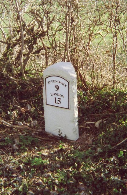
Image: © C Woodward Taken: 16 Mar 2007
Metal plate (replica) attached to stone post by the A21, in parish of ORPINGTON (BROMLEY District), Sevenoaks Road, East of Norsted Lane, Pratt's Bottom, on the verge beside hedge and large tree, on South side of road. Sevenoaks marker, erected by the Sevenoaks turnpike trust in the 19th century. Inscription reads:- SEVENOAKS 9 LONDON 15 (Mileages should be 8 and 16) Carved benchmark on lower face. Grade II listed. List Entry Number: 1186828 https://historicengland.org.uk/listing/the-list/list-entry/1186828 Milestone Society National ID: KE_LR16.
Images are licensed for reuse under creativecommons.org/licenses/by-sa/2.0
Image Location
Latitude
51.344608
Longitude
0.09956