Tollhouse by Coronation Road, Bedminster
Introduction
The photograph on this page of Tollhouse by Coronation Road, Bedminster by Alan Rosevear as part of the Geograph project.
The Geograph project started in 2005 with the aim of publishing, organising and preserving representative images for every square kilometre of Great Britain, Ireland and the Isle of Man.

There are currently over 7.5m images from over 14,400 individuals and you can help contribute to the project by visiting https://www.geograph.org.uk
Tollhouse by Coronation Road, Bedminster
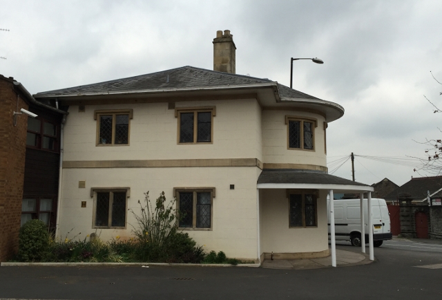
Image: © Alan Rosevear Taken: 14 Mar 2015
Tollhouse in the parish of Bristol (City of Bristol District), Ashton Gate Toll House, No. 285, Coronation Road, Bedminster, BS3. Grade II listed. List Entry Number: 1202160 https://historicengland.org.uk/listing/the-list/list-entry/1202160 Surveyed Milestone Society National ID: AV.BRI01
Images are licensed for reuse under creativecommons.org/licenses/by-sa/2.0
Image Location
Latitude
51.443178
Longitude
-2.617095