Old Caldon Canal milemarker now by Denstone bowling green
Introduction
The photograph on this page of Old Caldon Canal milemarker now by Denstone bowling green by Milestone Society as part of the Geograph project.
The Geograph project started in 2005 with the aim of publishing, organising and preserving representative images for every square kilometre of Great Britain, Ireland and the Isle of Man.

There are currently over 7.5m images from over 14,400 individuals and you can help contribute to the project by visiting https://www.geograph.org.uk
Old Caldon Canal milemarker now by Denstone bowling green
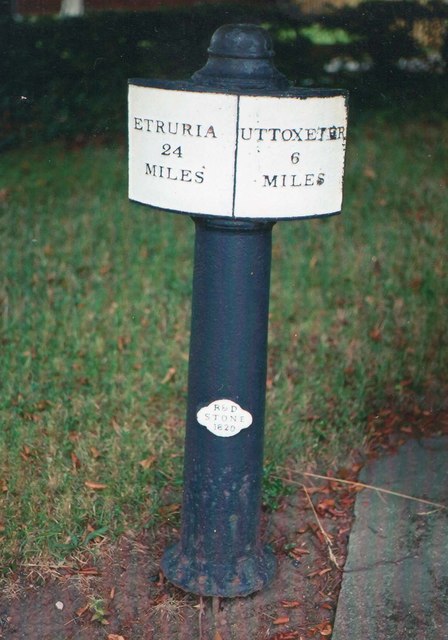
Image: © Milestone Society Taken: Unknown
Milemarker from the Caldon Canal, Uttoxeter Branch, in parish of Denstone (East Staffordshire District); was by Uttoxeter Canal, is now alongside the bowling green in Denstone. See also nearby: UTT-05 https://www.geograph.org.uk/photo/6095601 Inscription reads:- : ETRURIA / 24 / MILES : : UTTOXETER / 6 / MILES : Maker:- : R&D / STONE / 1820 : Surveyed Milestone Society National ID: UTT-06
Images are licensed for reuse under creativecommons.org/licenses/by-sa/2.0
Image Location
Latitude
52.963429
Longitude
-1.851944