Wellington Parade
Introduction
The photograph on this page of Wellington Parade by Ian Capper as part of the Geograph project.
The Geograph project started in 2005 with the aim of publishing, organising and preserving representative images for every square kilometre of Great Britain, Ireland and the Isle of Man.

There are currently over 7.5m images from over 14,400 individuals and you can help contribute to the project by visiting https://www.geograph.org.uk
Wellington Parade
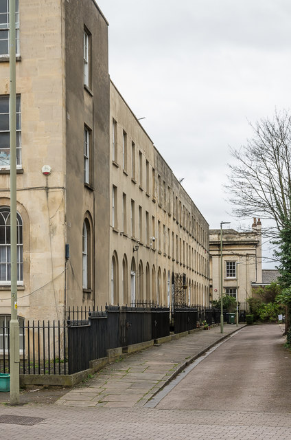
Image: © Ian Capper Taken: 16 Mar 2019
Uniform terrace of 7 houses built in 1814 on land sold to pay Land Taxes imposed to fund the Napoleonic Wars. Grade II listed - see www.historicengland.org.uk/listing/the-list/list-entry/1245479. On the left is part of 18 London Road (see Image), built at the same time and separately grade II listed - see www.historicengland.org.uk/listing/the-list/list-entry/1271699. At the far end is the later Picton House, built in 1825, described in the Pevsner guide as "severe Grecian" and also grade II listed - see www.historicengland.org.uk/listing/the-list/list-entry/1245437.
Images are licensed for reuse under creativecommons.org/licenses/by-sa/2.0
Image Location
Latitude
51.867022
Longitude
-2.238466