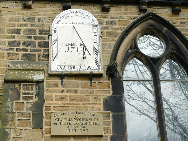
St Mark's, Longwood - sundial
Introduction
The photograph on this page of St Mark's, Longwood - sundial by Stephen Craven as part of the Geograph project.
The Geograph project started in 2005 with the aim of publishing, organising and preserving representative images for every square kilometre of Great Britain, Ireland and the Isle of Man.
There are currently over 7.5m images from over 14,400 individuals and you can help contribute to the project by visiting https://www.geograph.org.uk

Image: © Stephen Craven Taken: 18 Mar 2019
Not surprisingly, the sundial is on the south side of the church, but predates the present building (it bears the date 1749 and may have come from the previous church on a different site). It has been restored three times according to the church's listing, most recently in 1993 in memory of Cecelia Womersley. An unusual feature is that it bears latitude and longitude co-ordinates, and taken literally the longitude 25deg 35min West would refer to a point in the Atlantic Ocean, west of Ireland. The explanation, thanks to John Foad of the British Sundial Society, is that this is the "Plane's Longitude", the longitude of the location where the dial could be moved to, without rotation, to operate as a horizontal dial (still showing Longwood time, of course). It is a "pretty rare measure".

